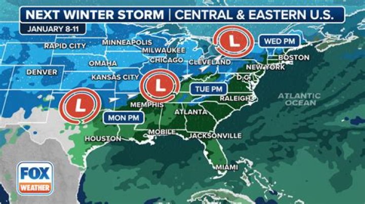
FRIDAY NIGHT UPDATE: There are no significant changes to the forecast for Monday into Tuesday. We’re still looking at rain going over to snow Monday evening and continuing Tuesday. Winds will be strong too, gusting up to 40 miles per hour.
6 inches of snow is possible in parts of our area, making this the biggest storm so far this season…
We’ll likely see Winter Weather Advisories and Winter Storm Warnings posted by Sunday for the Monday into Tuesday time period.
PREVIOUS POST:
After a pretty tame start to winter, things could get pretty messy by Monday night and Tuesday of next week.
A strong storm will barrel into the Midwest, bringing rain, snow and wind to millions of people.
In the Quad Cities, we could be facing moderate to heavy snow with winds gusting to near 40 mph!
There are still many details to work out as this storm is still more than a thousand miles away. A shift further North in the projected path could bring more rain into the picture. A shift further South could spell lighter snow totals early next week.
These details will be ironed out over the next 48 to 72 hours.
For now, be ready to change any travel plans if you have them TUESDAY of next week!